File:QTH locator.gif
Jump to navigation
Jump to search

No higher resolution available.
QTH_locator.gif (560 × 335 pixels, file size: 20 KB, MIME type: image/gif)
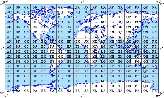
The Maidenhead Locator System divides the world into an 18 x 18 grid, with origin at (90°S, 180°W); these field divisions in turn may be split into a 10 x 10 array of squares.
File history
Click on a date/time to view the file as it appeared at that time.
| Date/Time | Thumbnail | Dimensions | User | Comment | |
|---|---|---|---|---|---|
| current | 19:12, 15 April 2009 | | 560 × 335 (20 KB) | Carlb (talk | contribs) | The Maidenhead Locator System divides the world into an 18 x 18 grid, with origin at (90°S, 180°W); these field divisions in turn may be split into a 10 x 10 array of squares. |
You cannot overwrite this file.
File usage
The following page uses this file: